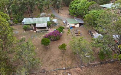
Acreage Drone Photography at Cedar Valley
The Mavic2Pro captures an acreage property for sale at Cedar Valley.
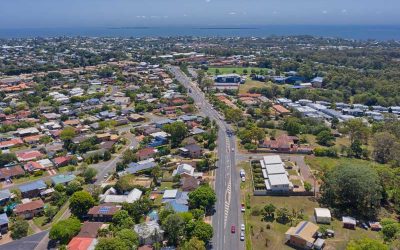
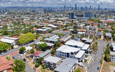
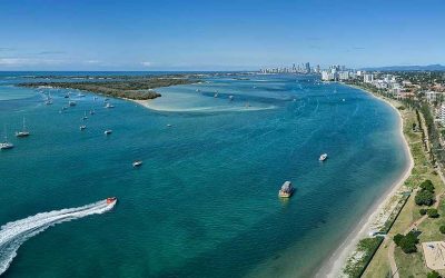
Drone Photography at Manly Rd, Manly West
Drone Photography at 100m over Manly Rd, Manly West to capture the proximity of a property for sale to the Morton Bay area.
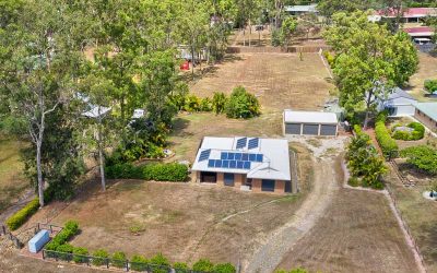
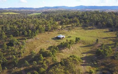
Drone Photography of Acreage Real Estate Flagstone
Capturing the size & layout of an acreage property for sale at Flagstone 10 metres to 80 metres above the ground.
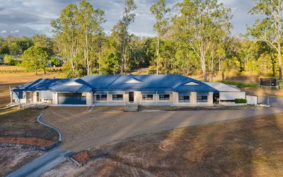
Drone Photography Acreage Real Estate for Elders Jimboomba
Using the Mavic2Pro drone to get elevated photographs of an acreage real estate listing for Elders Jimboomba.
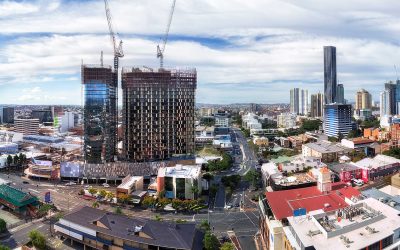
Drone Video over Coorparoo Brisbane with the Mavic 2 Pro
Flying the MavicPro 2 drone over Coorparoo to capture aerial 4k video for a new luxury apartment development site.

Drone Video of Land Development at Griffin
Aerial drone video plus 360 drone panorama of a development site at Griffin.
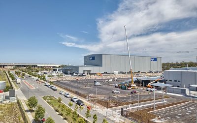
Drone Photography Heathwood Logistics Park Brisbane
A follow up visit to the Heathwood Logistics Park to capture drone video & a 360 degree panorama from 40m above the ground.
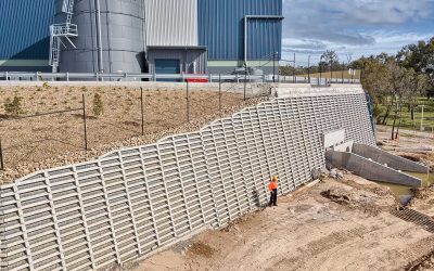
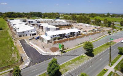
Aerial Photography for Concrib Crib Wall at Berrinba, Brisbane
Drone photography at 20-50m of a crib wall construction at Berrinba.
Aerial Photography Concrib Gabion Wall 17 Mile Rocks, Parklands Brisbane
Flying the MavicPro drone around a gabion wall constructed by Concrib Pty Ltd at a park at 17 Mile Rocks.
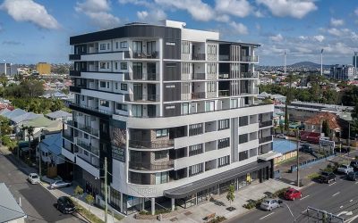
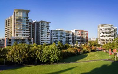
Aerial Photography for Constructions Group – The Marc at Kangaroo Point
Drone Photography for Constructions Group Constructions Group contacted DroneAce to capture aerial drone photography of The Marc, one of their newly completed residential apartments buildings in the heart of Kangaroo Point, Brisbane. We have captured similar aerial...
Brisbane Drone Photography June 2017
To extend the capabilities of any camera, (be it on a drone or on the ground) turn to panorama photography. Capture a sequence of images while rotating the camera and then use specialised stitching software to create a composite image. The image below is made up of 15...
BunyipSprings Farmstay Drone Video
BunyipSprings Farm Situated at the base of the beautiful Bunya Mountains in Queensland, Australia is BunyipSprings FarmStay, a traditional century old Australian farm set on over 620 acres of farmland and native bushland. The working farm combines both dairy and beef...
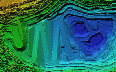
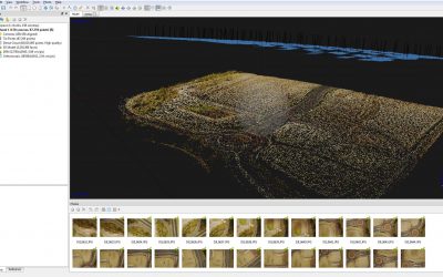
Geospatial Drone Mapping using Consumer Drones
Quarry Drone Mapping Introduction Using consumer drones for geospatial mapping is a skill set readily available to any competent drone pilot. Drone mapping Mount Coot-tha Quarry in Brisbane was one of the first mapping projects we undertook. At DroneAce, we have been...
Brisbane drone panorama photography montage
Using the DJI MavicPro to take aerial drone panoramas around Brisbane The first few months of 2017 saw Droneace busy undertaking a range of aerial drone panoramas projects in and around Brisbane and the Gold Coast region. We mainly utilised the DJI MavicPro, as it is...

MavicPro Drone Panorama Photography
Introduction to Drone Panorama Photography MavicPro drone panorama photography is both a challenging and rewarding persuit. We are going to show you how to get the most out of your drone and extend its image capture capabilities by looking at what is involved in...
Drone Photography Brisbane April 2017
Some of our favorite Brisbane & Gold Coast drone photographs captured during April 2017. We used the MavicPro as a flying tripod for the following landscape and cityscape photographs due to its low noise characteristics, small footprint and ease of use. Drone...

Drone Photography Brisbane
The many uses of Drone Photography around Brisbane Drone photography around Brisbane is benefiting a wide range of industries that realise the benefits of using drones, or unmanned aerial vehicles (UAVs) as affordable aerial imaging platforms. Today’s small and...
Drone Mapping
What is Drone Mapping Drone mapping is using a camera equipped fixed wing or rotary wing drone also known as a UAV or UAS in conjunction with an autonomous flight controller application on a tablet, smartphone or laptop to acquire data via a sequence of images using...
Aerial Drone Photography for Brisbane Real Estate
Boost Your Real Estate Marketing with Aerial Photography Aerial Drone Photography for Brisbane Real Estate How aerial drone real estate photography helps Brisbane agents with property sales Aerial drone photography for Brisbane real estate property marketing is one...