Drone Panorama Photography
Aerial drone panorama photography is a technique that uses the capturing and processing of multiple overlapping photographs from a scene or vista and combining or stitching them together using specialised software programs such as Auto Pano Giga or Microsoft Image Composite Editor (ICE) to create a high resolution composite panorama.
The resulting panorama is an image with a horizontally elongated field of view resulting in an impressive ultra wide perspective.
Aerial Drone Panorama Photography Benefits
1. High resolution final image, ideal for large, detailed prints
2, Capture all the essential elements into a photograph
Video montage of aerial drone panorama photographs taken around Brisbane & South East Queensland
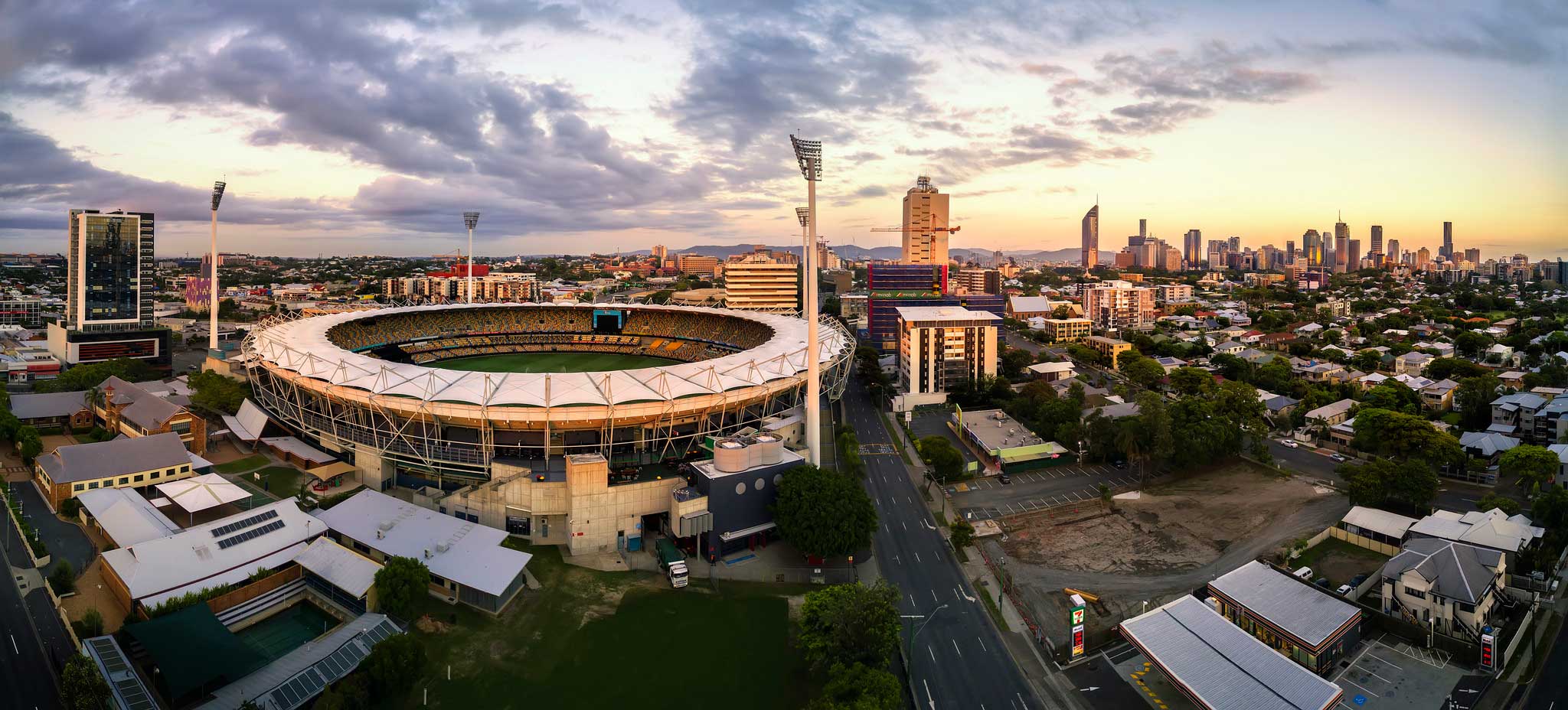
Woolloongabba Stadium aerial drone Panorama
We captured this Brisbane icon using 17 high resolution portrait orientated RAW photographs and used AutoPano Giga for the final aerial panorama stitching. Early morning, soft light with the Brisbane CBD in the background, perfect for aerial photography.

DroneAce are the experts in creating aerial drone panorama photographs
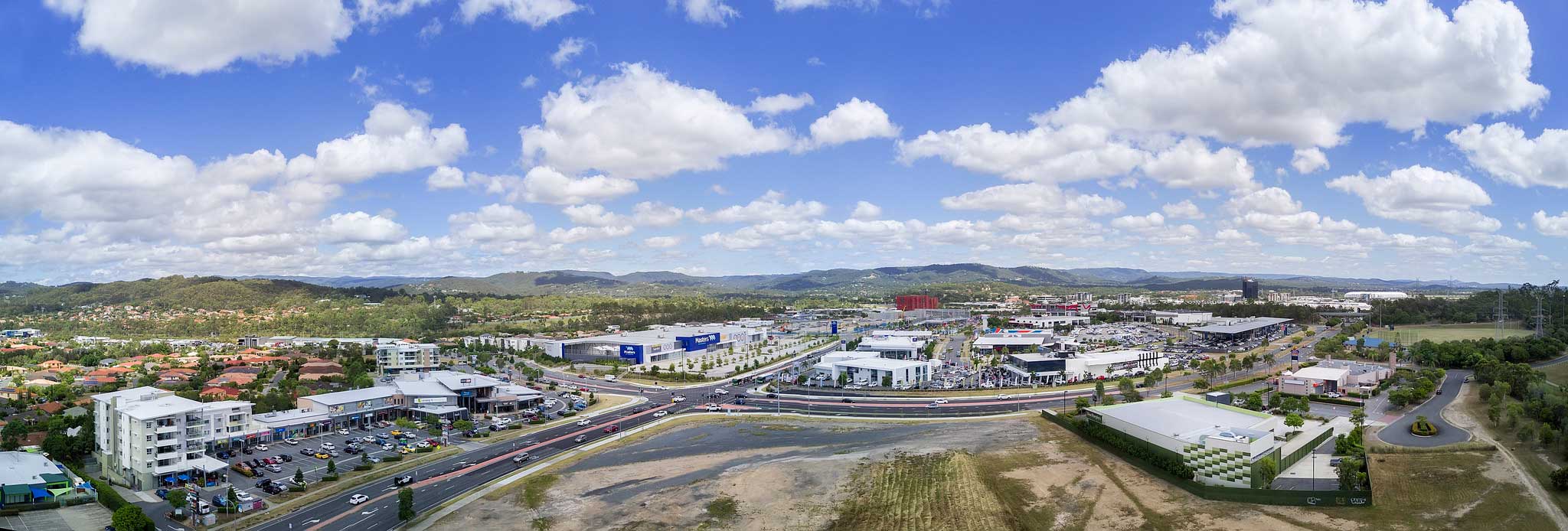
Robina Shopping Precinct Aerial Panorama Photography
16 high resolution RAW photographs went into the creation of this aerial panorama. Stitched using AutoPano Giga.

When you need to print BIG, use aerial drone panorama photography
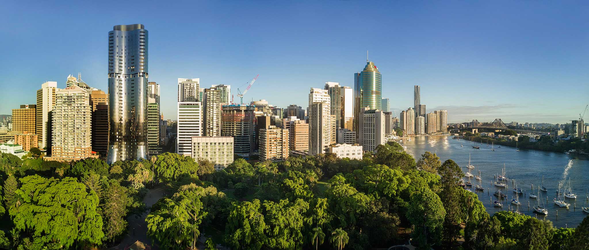
Brisbane City aerial panorama photograph Brisbane Botanic Gardens DroneAce
7 high resolution RAW photographs went into the creation of this aerial panorama. Stitched using AutoPano Giga. We photographed early morning and composed the photograph capturing the Abian Tower on the left hand side with the rest of Brisbane city spreading out to the right ending off with the Story Bridge.

To get the detail, think aerial drone panorama photography
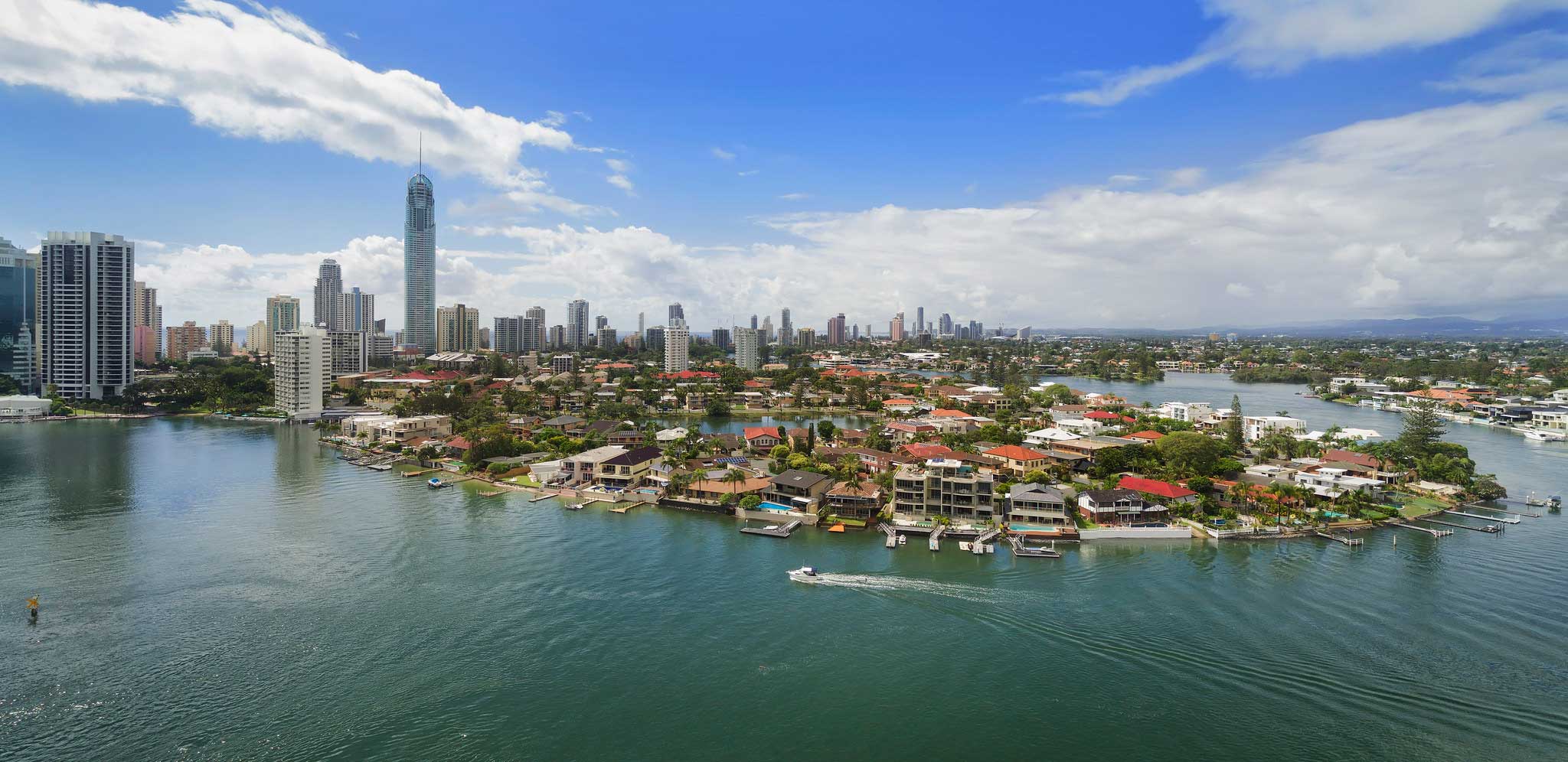
Aerial panorama photography of Southport waterways & surrounds
We used our UAV drone to capture 7 high resolution RAW photographs and then processed them with AutoPano Giga to create this high resolution aerial panorama.

